Selwyn Project
Selwyn Project
Red Fox has ten EPMs in a contiguous area 5km south of Selwyn in the Cloncurry District of Northwest Queensland. The area lies between the Mt Dore (111Mt @ 0.55% Cu, 0.1g/t Au) and Merlin (6.4Mt 1.5% Mo, 0.3% Cu and 26g/t Re) deposits in the north and Osborne deposit (36Mt @ 2% Cu, 1g/t Au) in the south.
Host sequence dominated by Concorde Thust system similar to the Mt Dore Thrust (3Mt copper, 4.8MOz gold endowment).
Red Fox has defined five high priority targets in the area and numerous other prospects that require assessment. The five key prospects are:
- Mt Ulo Cu-Co prospect
- Jasper Ridge Cu-Co prospect
- Camel Dam Cu-Au prospect
- Wallaby IRG Au prospect
- Mt Ulo-Perisher Zn-Pb-Ag prospect
Download our most recent Selwyn presentation here.
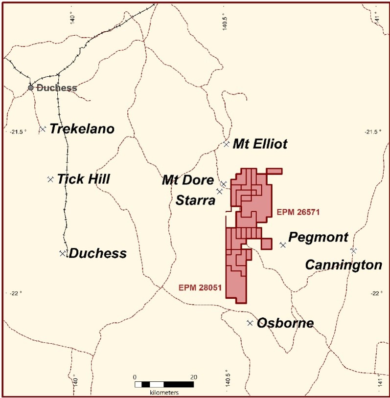
Selwyn Project – Location Plan
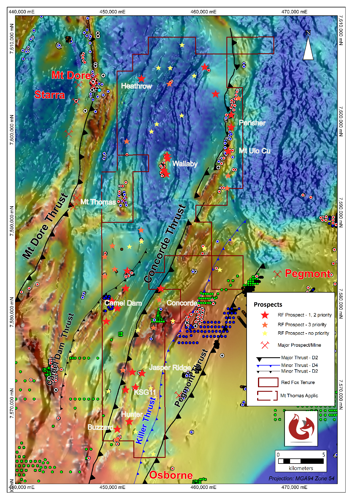
Selwyn Project prospect ranking
MT ULO – Cu-Co Prospect
An 880m by 270m area averaging 0.22% Cu in rock chips fetauring a significant uranium anomaly, with cobalt, iron and manganese, coinciding with anomalous gravity and chargeability responses.
- EPM 26571 (Mt Carol)
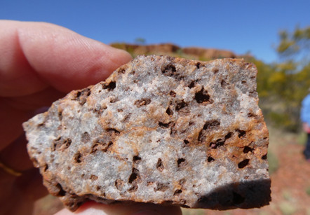
Red Fox’s Mt Ulo Cu-Co prospect is the most significant copper target in the Selwyn Project area which is ready for drilling.
The target is defined by a (dark) colour anomaly on the ground which correlates with high iron and managese content of the outcropping rocks. This zone is anomalous in copper, cobalt, gold and uranium. The zone is well defined by previous soil sampling for copper, the anomalous copper area correlating with a strong uranium channel radiometric anomaly which is confirmed by high uranium values up to 202ppm U in rock chip samples. Cobalt is also anomalous in the area although much of the previous soil sampling was not analysed for the element. Soil surveys peripheral to the anomalous zone showing rising coablt on the edges of the zone. Rock samples by Red Fox have also returned cobalt values up to 235ppm Co.
The zone is 880m long and up to 270m wide. Rock chips from the zone (collected by various previous explorers and Red Fox, totalling 117 samples) average 0.22% copper.

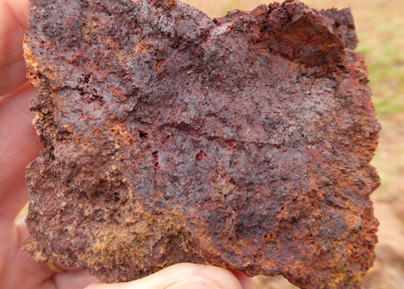
Mt Ulo – gossan 1790ppm Cu, 235ppm Co, 1175ppm Zn
Two IP lines by previous explorers showed moderate chargeability responses in the target zone. Red Fox carried out a detailed gravity survey in the area which also showed a subtle gravity anomaly in the target area.
In 1972 previous explorers drilled three shallow holes in the zone with a maximum depth of 44m. UR02 drilled in the central part of the anomaly returned 9m @ 0.2% Cu at the bottom of the hole.
Red Fox will complete confirmatory geological mapping to define mineralised structures and additional infill soil and rock chip sampling to refine the drill targets prior to drilling.

Mt Ulo/Perisher Copper in soils

Mt Ulo Copper Target

Mt Ulo Copper target – Cobalt in soils over Uranium image
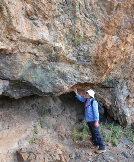
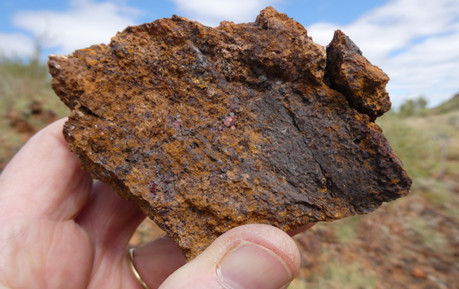
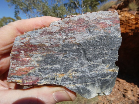
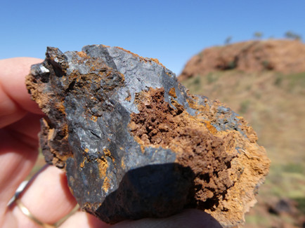
Mt Ulo east side showing malachite staining
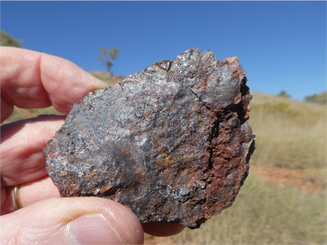
Mt Ulo gossan outcrop west side
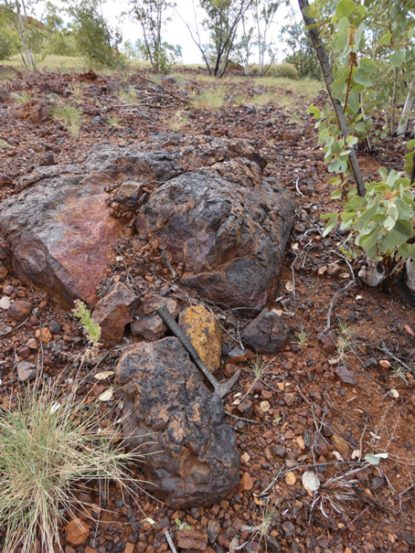
Mt Ulo gossan outcrop
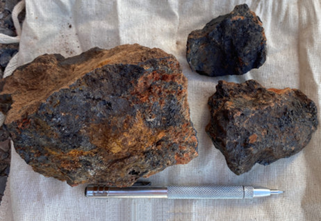
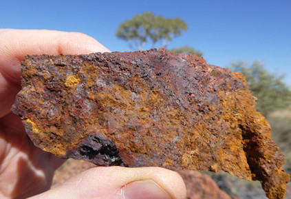
Mt Ulo gossan 2160ppm Cu, 1365ppm Co, 2380ppm Zn
Mt Ulo gossan – 2140ppm Cu
JASPER RIDGE and KSG11 Cu-Co Prospect
Previous drilling intersects 7.8m @ 0.97% Cu, 0.39% Pb from 32m to 39.8m (end of hole). Lode horizon identified over at least 7km strike.
- EPM 28051
The Jasper Ridge – KSG11 target lies in the same stratigraphic position as the Mt Ulo Copper Cobalt target, hosted by a “lode horizon” of sulphide (pyrrhotite) bearing microcline quartzites and albitic quartzites, carbonaceous schists and calc silicates within the Hampden Slates. The lode horizon extends north and south of Jasper Ridge but is poorly exposed to the north. Additional gossans have been defined within the lode horizon over 7km. The KSG11 prospect lies on the lode horizon 2km south of Jasper Ridge.
KSG11 prospect – subdued outcrop
KSG11 prospect has had one previous drill hole targeting a magnetic anomaly, not located to test the gossanous lode horizon.
Rock chip samples by Red Fox from the Jasper Ridge – KSG11 zone have returned up to 0.26% Cu, 680ppm Co and 0.19% Zn.
Previous soil sampling has been very wide spaced and requires infill sampling to define the hotspots accurately.
Red Fox will trace the lode horizon to the north and south, complete soil and rock chip sampling and geological mapping to define hot spots along the horizon which should quickly develop into drill targets.

Jasper prospect area – Copper in Soils
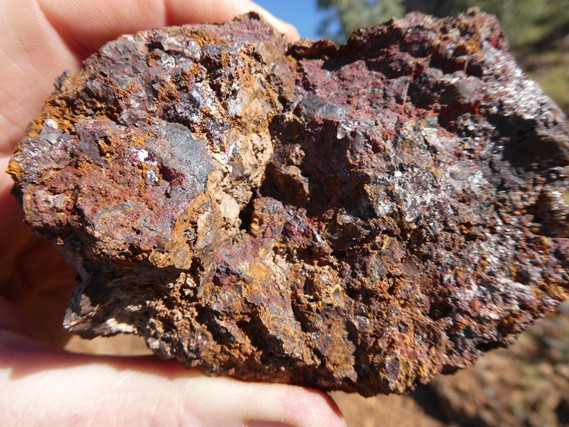
Jasper Ridge siliceous gossan 1440ppm Cu, 1700ppm Zn
Jasper Ridge gossan 2160ppm Cu, 527ppm Co, 1895ppm Zn
Jasper Ridge pyrrhotite rich albitic quartzite
KSG11 gossan 2990ppm Cu
KSG11 gossan 2320ppm Zn 368ppm Cu
CAMEL DAM – Cu-Au Prospect
Folded sequence of shales and mafic volcanics with multiple undrilled EM targets, anomalous copper and gold values from gossanous rocks in a poorly outcropping terrain.
- EPMs 18073, 25192 and 28007
The Camel Dam prospect is a poorly outcropping area of Hampden Slates which are tightly folded (D3) and adjacent to the Camel Dam Thrust Fault. The sequence is conductive and radiometrically anomalous in uranium and has an unfolded strike length of approximately 12km.
The zone is geochemically anomalous although geochem surveys have been patchy. Rock chip samples from work by Red Fox and others has returned anomalous copper and gold results from poorly outcropping gossanous rocks. Rock chip samples have returned values up to 3.7 and 1.84g/t Au, 0.18% Cu, 539ppm Co and 0.19% Zn.
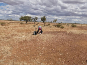
Camel Dam field view, vicinity of 3.7g/t Au rock chip sample
Limited shallow RAB drilling has been done on 5 wide spaced lines by a previous explorer who returned best result of 5m @ 0.83g/t Au in the E231 target area.
Red Fox has identified AEM anomalies and uranium channel anomalies associated with the hinge zones of the folded sequence where metals are most likely to accumulate.
Further evaluation of the EM data is in progress and further soil and rock chip sampling and mapping is anticipated.
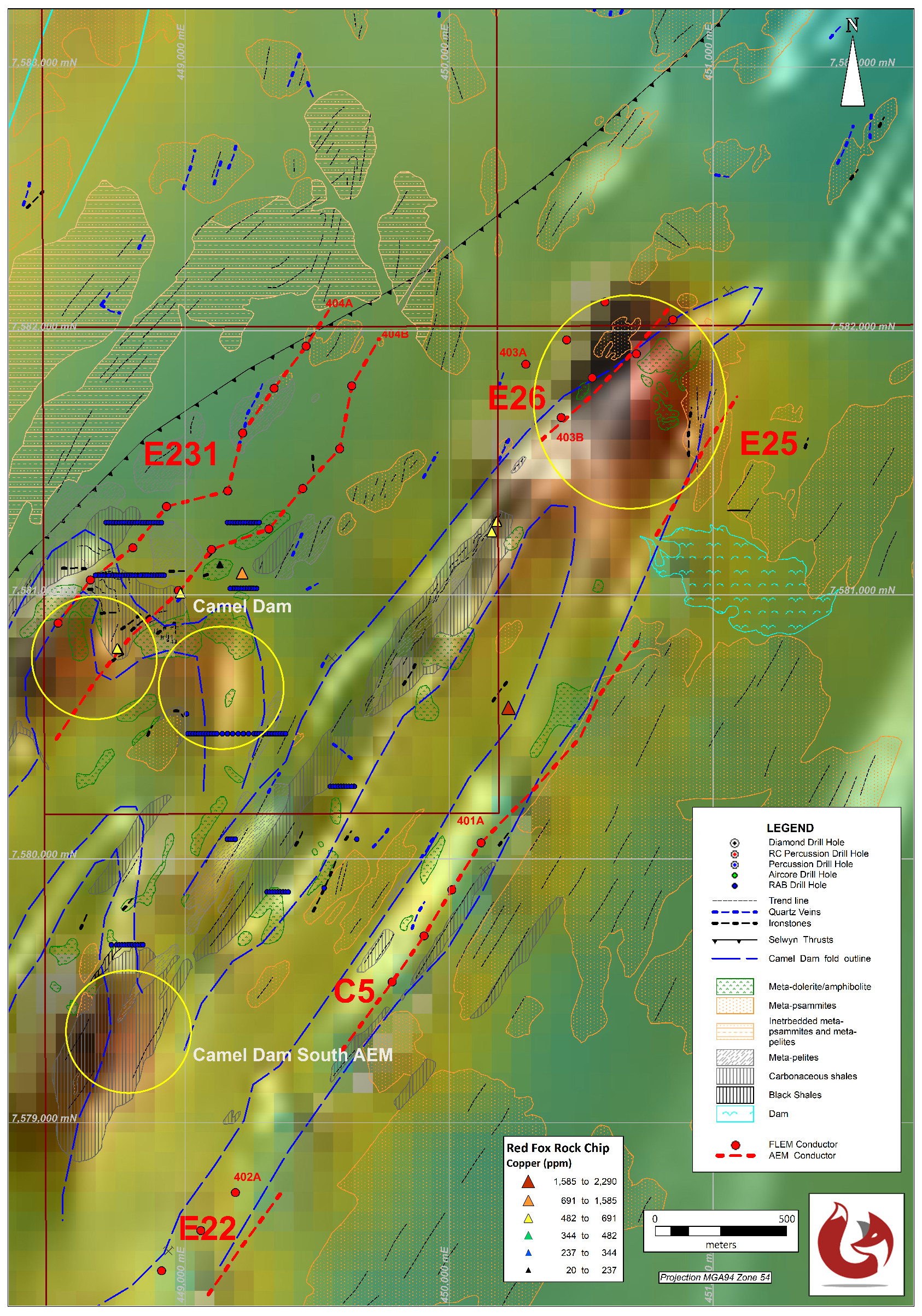
Camel Dam Prospect – showing copper in rock chips over AEM image

Camel Dam Prospect showing copper in soils over Uranium channel radiometrics

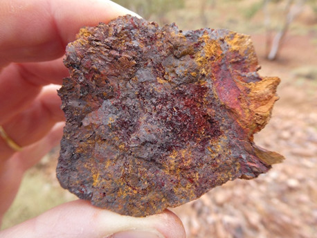
Camel Dam Gossan, vicinity of 3.7ppm Au in rock chip sample

Camel Dam Gossan 0.86ppm Au, 1490ppm Co, 2020ppm Pb
WALLABY – Au Prospect
Previous drilling intersects 12m @ 1.17g/t Au in IRG style setting. Previous geochemistry limited by extreme regolith.
- EPM 26571 (Mt Carol)
The target at Wallaby is an IRG style gold deposit (e.g Kidston 3MOz gold). Previous exploration in the area has defined anomalous gold in soils over three distinct areas, south, central and north Wallaby. Each of these has had some drilling with the best results from South Wallaby:
- WARC-01 – 24-36m, 12m @ 1.17g/t Au
- WARC-02 – 0-10m, 10m @ 1.00g/t Au
- WARC-04 – 114-118m, 4m @ 1.04g/t Au
- WARC-06 – 52-60m, 8m @ 0.69g/t Au
- WBRC-01 – 7-10m, 3m @ 0.82g/t Au
- WBRC-03 – 49-52m, 3m @ 0.95g/t Au
Drilling was targeting the anomalous gold in soil sampling by BMA.
Red Fox notes that all of the anomalous soil zones are in areas of low relief, separated by upstanding highly silicified and leached rocks related to the Mesozoic surface. We interpret this to mean that the anomalous gold zones are likely more extensive than indicated and probably extend under the Mesozoic surface.
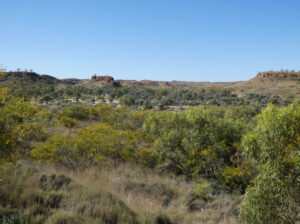
Wallaby Prospect – terrain view showing Mesozoic surface
Red Fox proposes to carry out geological mapping with additional rock chip sampling to try and define the mineralising structures in order to trace them under the Mesozoic surface.

Wallaby Prospect – Gold in Soils

Wallaby South – siliceous altered intrusive
Wallaby South altered intrusive, 0.27gt Au
PERISHER-MT ULO – Pb-Zn-Ag Prospect
13km of anomalous black shale stratigraphy showing elevated lead and zinc values, areas of strong iron enrichment, spongy gossans with only shallow drilling by previous explorers.
- EPM 26571 (Mt Carol)
The target at Perisher-Mt Ulo lead zinc prospect is a Sedex style deposit (Century – 118Mt @ 10.2% Zn, 1.5% Pb, 36g/t Ag) associated with black shales, silicified shales, and ferruginous breccias.
A 13km strike length of anomalous lead and zinc in the black shale stratigraphy has been identified. The bulk of the zone is untested, although some shallow drilling (1982) has returned 3.05m @ 2.08% Pb and 16g/t Ag. Wider zones of mineralisation include 30m @ 0.42% Pb and 8.6g/t Ag (Perisher Prospect).
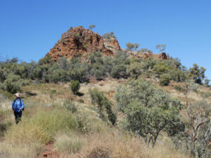
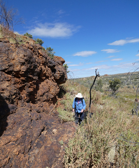
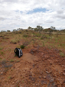
Perisher Prospect – terrain view
Previous work at Mt Ulo has focused on the lead anomalies, leaving the main zinc target untested. This is a walk-up drill target, 600m strike length.
Red Fox will also complete additional infill soil and rock chip sampling and geological mapping to define hot spots along the stratigraphy to develop additional drill targets.

Perisher-Mt Ulo Zinc Geochemistry
Perisher – siliceous gossan 0.7% Cu, 0.35% Pb, 655ppm Zn
Perisher iron rich siliceous gossan
MT THOMAS – Cu-Zn Prospect
Red Fox has been awarded priority on EPM application over the Mt Thomas Prospect. The area is prospective as it has:
- Banded iron formations or ironstones associated with
- Known lead zinc mineralisation
- Significant U2/Th anomaly in radiometrics
- Untested gravity, magnetic and conductivity anomalies
EPMa 29361 (Mt Thomas)
Previous work at Mt Thomas has focused on the iron formations as a BHT style lead/zinc target.
Red Fox will focus it exploration on the untested AEM and magnetics/gravity targets and the copper potential of the area.
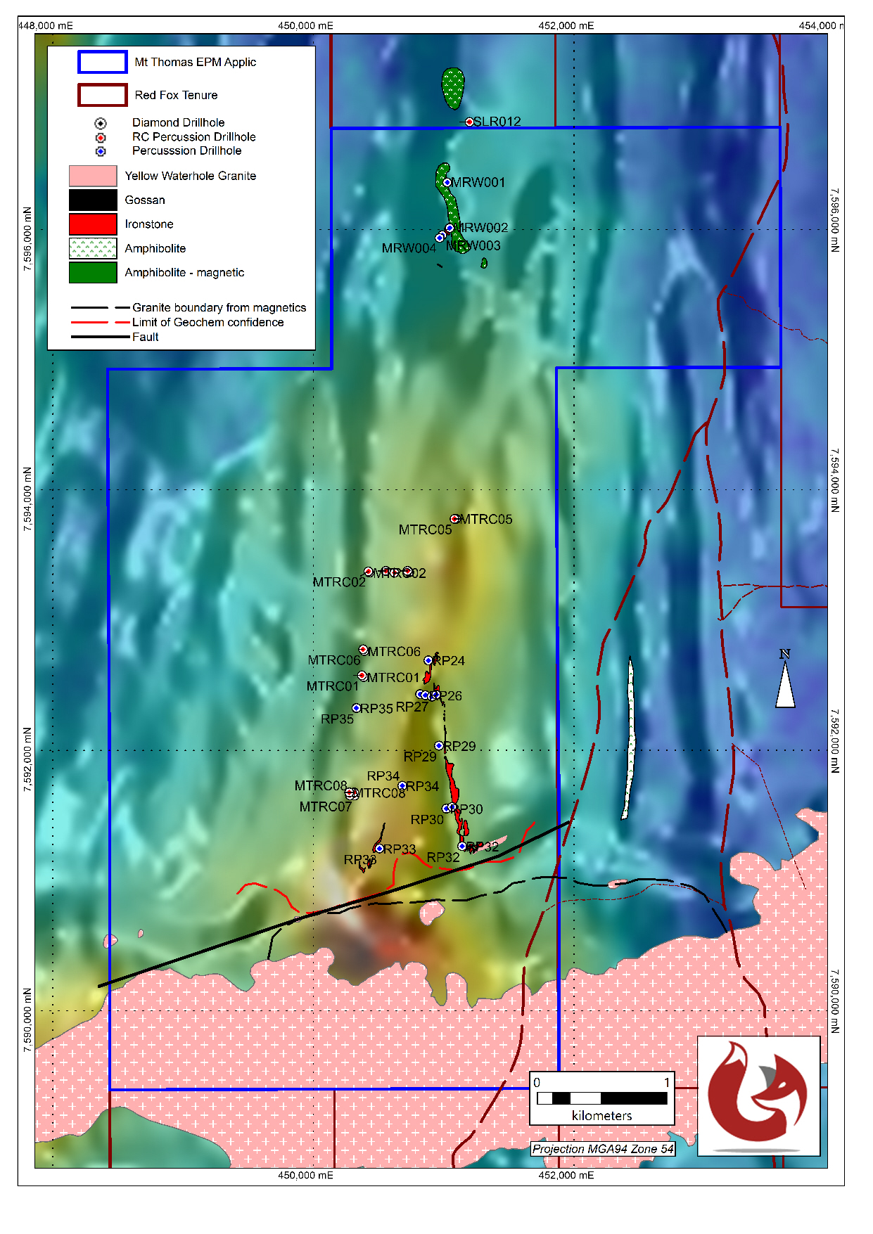
Mt Thomas BIFs
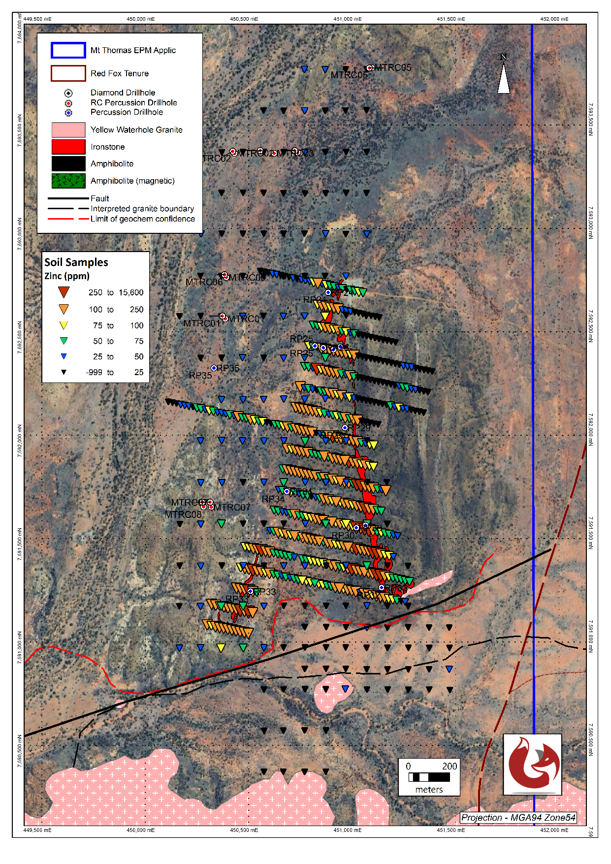
Mt Thomas zinc in soils
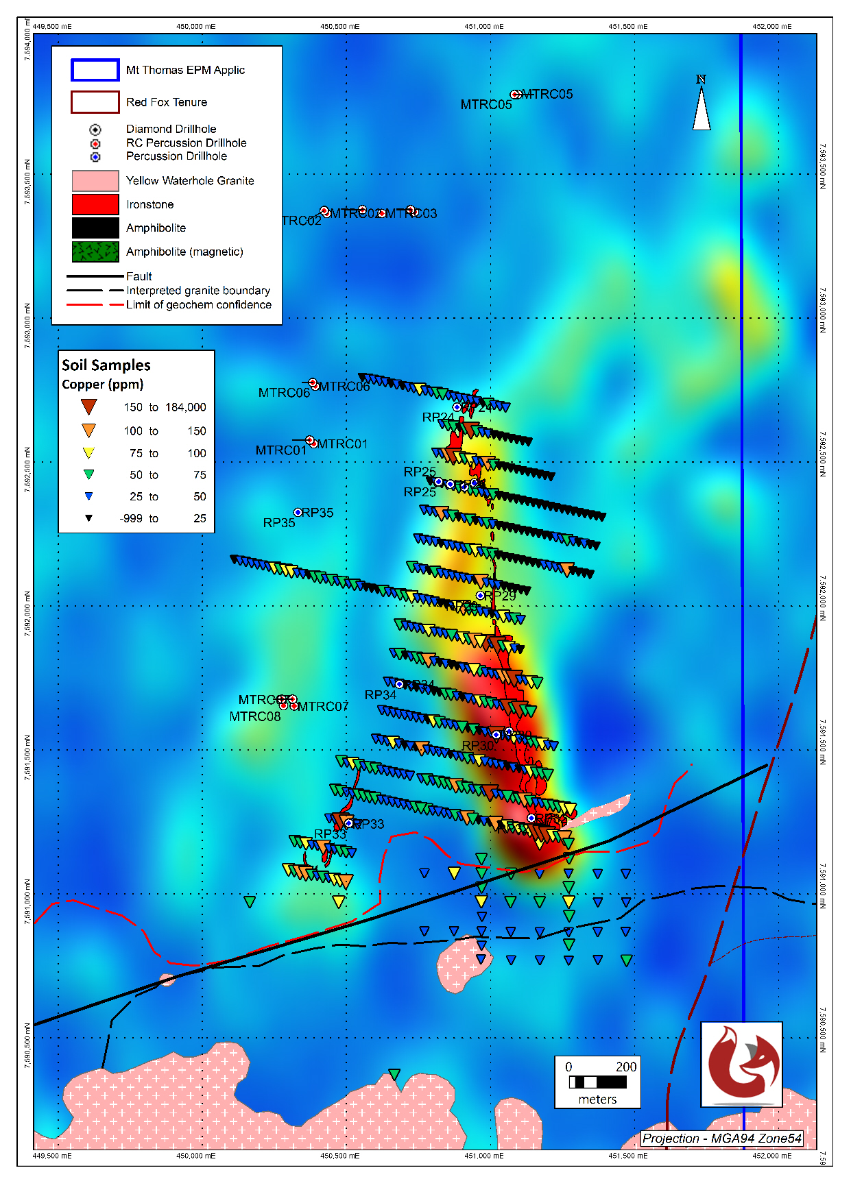
Mt Thomas copper in soils
